

Satellite Finder - Dish Pointer

توضیحات Satellite Finder - Dish Pointer
satellite director dish & satfinder app (Satellite Finder) is a tool which will help you to set up your dish tv
satellite It will give you azimuth, elevation and LNB tilt for your directv location (based on GPS) and on the
chosen satellite from list The result is shown both as numeric data and graphical on google maps.
It has also built in compass which will help you to find proper satellite azimuth. It also can use augmented reality to sat tv show where is satellite map on camera view.
Find a TV antenna or a satellite, in azimuth, can be pretty hard. Before but you can find easily with a compass, magnetic variation compass azimuth and azimuth of the satellite.
Satellite Director replaces all that.
How this app works :
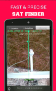
- The azimuth, height and skew edge is figured for your area and picked satellite guide. Under ascertained qualities there is a compass with graphical portrayal of azimuth edgeThe azimuth point is ascertained with attractive tendency Keep in mind each time you utilize compass
you ought to align it.
Green line speaks to your telephone azimuth So if on compass green and red markers are on each other front of the telephone should indicate you heading to the satellite director. locator If the compass esteem is right – telephone azimuth esteem will practice environmental safety.
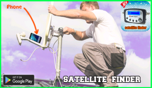
Just enable the GPS in your phone or enter your GPS position, select the desired TV satellite and point your phone to the sky to target (find) the TV satellite. You found the satellite when the white ball is in the white circle and the cyan ball is in the cyan circle. Align, azimuth, the offset arm of the satellite dish to the cyan arrow on the screen phones and the dish is aligned in azimuth with the satellite.
In the event that application discovered your area, you should choose satellite definition wanted satellite director. To do this you should discover symbol with amplification glass and tap it. On the rundown you will discover all satellites director with rise point over zero degrees. Keep in mind: satellite guide name doesn't influence the computation of edges. Imperative thing is satellite director position.
برنامه ماهواره ای و برنامه اسکایپ (ماهواره یاب) یک ابزار است که به شما کمک می کند تا تلویزیون خود را تنظیم کنید
ماهواره ای آن را به شما می دهد azimuth، ارتفاع و LNB شیب برای موقعیت مستقیم خود را (بر اساس GPS) و در
ماهواره انتخاب شده از لیست نتیجه در هر دو صورت داده های عددی و گرافیکی در نقشه های گوگل نشان داده می شود.
این همچنین در قطب نما ساخته شده است که به شما کمک می کند تا آئومیت ماهواره ای مناسب پیدا کنید. همچنین می تواند از واقعیت تقویت شده برای نمایش تلویزیون در جایی که نقشه ماهواره ای در نمای دوربین است، استفاده کند.
پیدا کردن یک آنتن تلویزیون یا یک ماهواره، در آسیموت، می تواند خیلی سخت باشد. قبل از اینکه شما می توانید به آسانی با یک قطب نما، قطب نمای مغناطیسی، azimuth و azimuth از ماهواره پیدا کنید.
کارگردان ماهواره جایگزین آن می شود.
چگونه این برنامه کار می کند:
- Azimuth، height و edge edge برای منطقه شما شکل گرفته است و راهنمای ماهواره ای را انتخاب می کند. با توجه به کیفیت مشخص شده، یک قطب نما با تصویر گرافیکی از لبه azimuth وجود دارد نقطه azimuth با تماشای جذاب مشخص می شود در هر بار که از قطب نما استفاده می کنید، در نظر بگیرید
شما باید آن را هماهنگ کنید.
خط سبز به آسیمیت تلفن شما صحبت می کند بنابراین اگر قطب نما نشانگرهای سبز و قرمز در قسمت های مختلف تلفن باشد باید به مدیر ماهواره ای اشاره کرد. Locator اگر احترام قطب نما درست است - عزت نفس تلفن ایمنی زیست محیطی را اعمال خواهد کرد.
فقط GPS را در گوشی خود فعال کنید یا موقعیت GPS خود را وارد کنید، ماهواره تلویزیون مورد نظر را انتخاب کنید و تلفن خود را به آسمان هدایت کنید (ماهواره ای را پیدا کنید). هنگامی که توپ سفید در دایره سفید قرار دارد، ماهواره شما را پیدا کرده و توپ جیبی در دایره ای آبی رنگ است. زنجیر، آستانه، بازوی افستی از ظرف ماهواره به فلش سایان بر روی صفحه نمایش گوشی ها و ظرف در ماهیت با عظیم تراز می شود.
در صورتی که برنامه منطقه شما را کشف کرد، باید تعریف ماهواره ای را به عنوان مدیر ماهواره ای انتخاب کنید. برای این کار باید سمبل را با شیشه تقویتی کشف کنید و روی آن ضربه بزنید. بر خلاف پیش بینی شما تمام ماهواره های کارگردان را با نقطه افزایش بیش از صفر درجه کشف خواهید کرد. به یاد داشته باشید: نام راهنما ماهواره بر محاسبات لبه تاثیر نمی گذارد. چیزی مهم است موقعیت موقعیت ماهواره ای است.

